
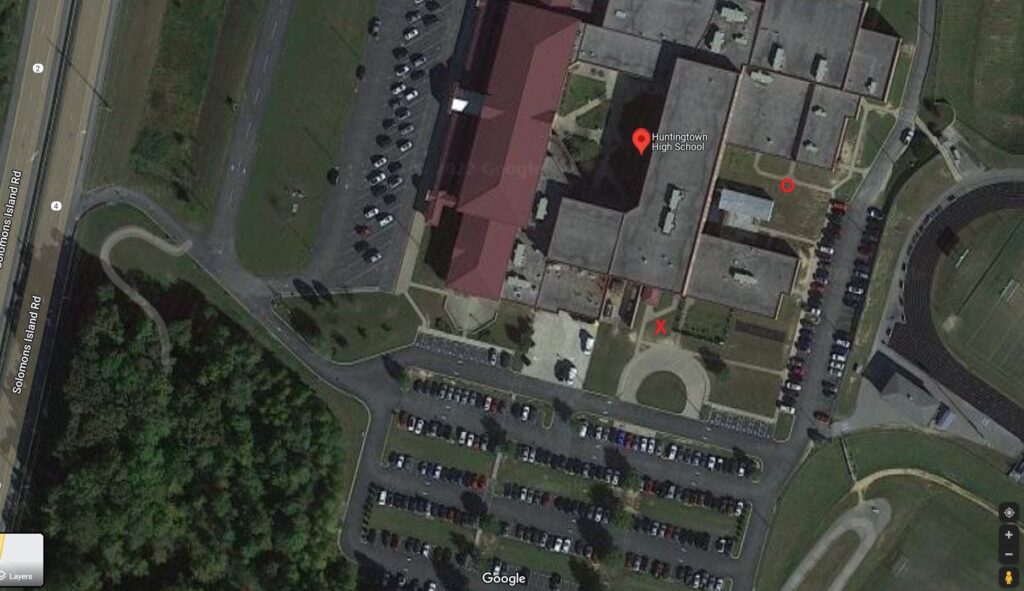
Here’s a picture of the antenna location we used for this exercise. The red X marks the spot. The red O is the location we used in previous hurricane/tropical storm activation’s.

Here’s a picture of the antenna location we used for this exercise. The red X marks the spot. The red O is the location we used in previous hurricane/tropical storm activation’s.